The Cambrian Way is the unofficial, evocative name given to the route that largely follows the A470 trunk road, stitching together the entire length of Wales from its capital, Cardiff, in the south, to the Victorian seaside town of Llandudno in the north. Spanning approximately 186 miles (299 km), the A470 is the country’s longest road and serves as a vital artery and one of the most scenic drives in the UK.
The road is far more than a simple transport link; it is a journey through the very heart of Welsh identity, linking cosmopolitan cities, former industrial heartlands, tranquil market towns, and some of the most dramatic mountain landscapes in Britain.
Route and Landscape Diversity
The A470’s character changes dramatically along its four main sections, offering a microcosm of Welsh geography and culture:
South Wales Expressway (Cardiff to Merthyr Tydfil)
The journey begins at Cardiff Bay, near the Wales Millennium Centre, and quickly becomes a modern, high-speed dual carriageway. This section cuts through the former South Wales Valleys coal-mining and iron-working region, including towns like Pontypridd and Merthyr Tydfil. Although a busy commuter route, it offers glimpses of the area’s rich industrial heritage, now largely re-greened.
Through the Bannau Brycheiniog (Brecon Beacons)
Heading north, the road enters the magnificent Bannau Brycheiniog National Park (formerly the Brecon Beacons). It climbs steeply past reservoirs and reaches its highest point at the Storey Arms pass. This single-carriageway section offers breathtaking views of the peaks, including Pen y Fan, before descending to the historic market town of Brecon.
The Heart of Mid Wales (Brecon to Dolgellau)
The middle section of the Cambrian Way is arguably the most winding and remote, passing through the sparsely populated Cambrian Mountains and the upper reaches of the River Wye valley. Key points include:
- Builth Wells: A historic spa and market town famous for hosting the Royal Welsh Show.
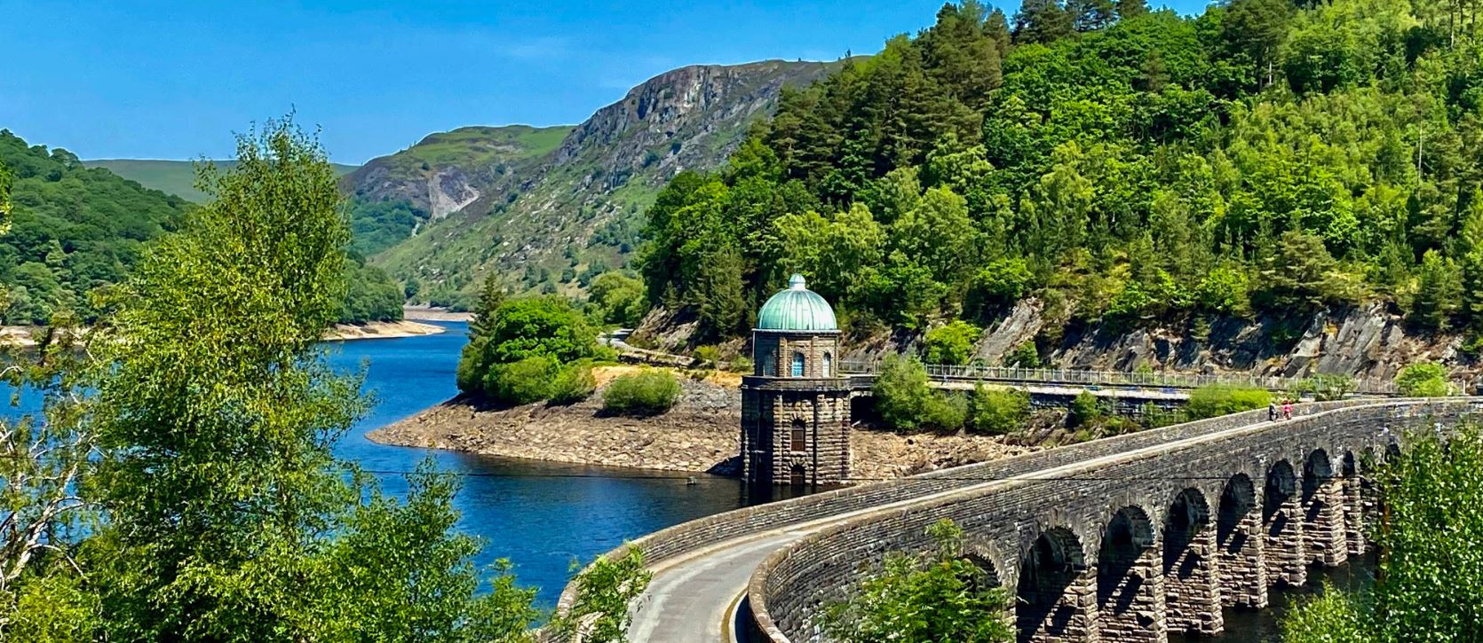
- Rhayader: The gateway to the stunning Elan Valley Reservoirs (a worthwhile detour) and an area renowned for the reintroduction of the Red Kite.
- Llanidloes: A historic market town at the headwaters of the River Severn. This part is a classic rural drive, with many twists and turns that demand careful attention.
Into Eryri (Snowdonia) (Dolgellau to Llandudno)
As the Cambrian Way enters Eryri National Park (Snowdonia), the landscape becomes more rugged and dramatic. It passes through or near areas famed for their slate industry, such as Blaenau Ffestiniog, and tourist hubs like Betws-y-Coed. The road offers spectacular mountain passes and forest views before eventually flattening out to meet the North Wales coast at Llandudno.
Highlights and Places of Interest
The Cambrian Way is a popular road trip route due to the concentration of key Welsh attractions along its length:
| Area | Attraction | Description |
| South | Castell Coch | A romantic, Gothic Revival “fairytale castle” near Cardiff. |
| A Welsh Coal Mining Experience | Guided tours by former miners at the Rhondda Heritage Park. | |
| Bannau Brycheiniog | Brecon Mountain Railway | A heritage steam railway offering scenic views of the National Park. |
| Pen y Fan | The highest peak in South Wales, accessible from the Storey Arms. | |
| Mid Wales | Elan Valley | A series of Victorian dams and reservoirs surrounded by moorland (requires a short detour). |
| Gigrin Farm | A feeding station providing spectacular views of hundreds of Red Kites. | |
| Eryri (Snowdonia) | Blaenau Ffestiniog | The “Slate Capital of the World,” now home to adventure activities like Zip World. |
| Coed y Brenin Forest Park | Famous for its extensive mountain biking and walking trails. | |
| North | Llandudno | A classic Victorian seaside resort, featuring a pier and the Great Orme cable car. |
Export to Sheets
Historical Context of the Cambrian Way
The Cambrian Way as it exists today is a relatively modern construct. Its official extension northwards from its original terminus in Brecon to Glan Conwy near Llandudno occurred in stages, primarily during the late 20th century. This involved renumbering and absorbing older, existing routes (like the A487 and parts of the A44), which is why the road’s quality and style are so variable.
The strategic decision to create a single, continuous trunk road linking the north and south was driven by a desire to improve communication and economic ties across Wales, reinforcing a sense of national unity and facilitating access to its primary National Parks for tourists. Though parts of the road—especially the dual carriageway stretch near Cardiff—are of modern expressway standard, much of the central and northern sections remain a challenging, yet rewarding, single carriageway drive through the mountainous interior.